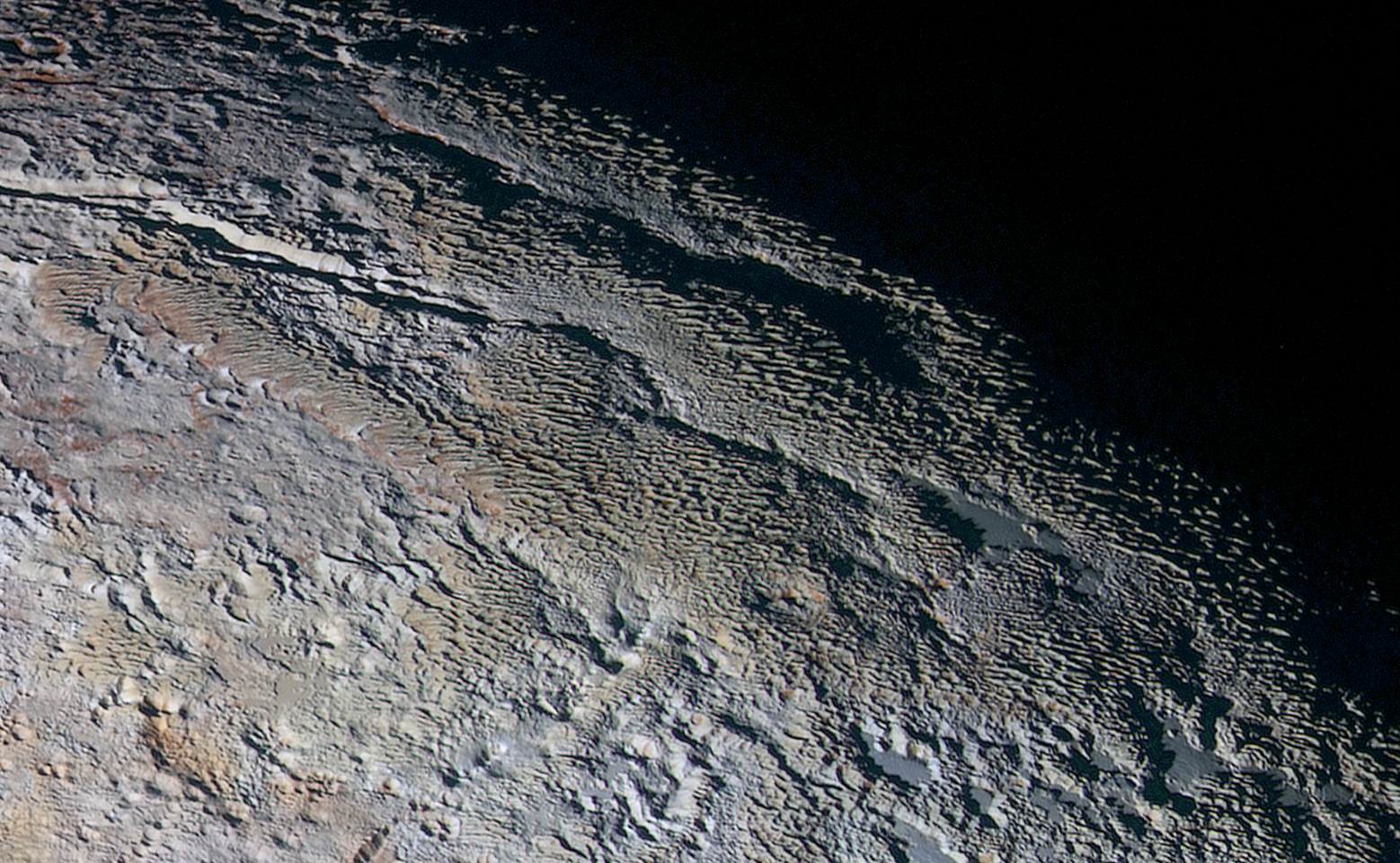
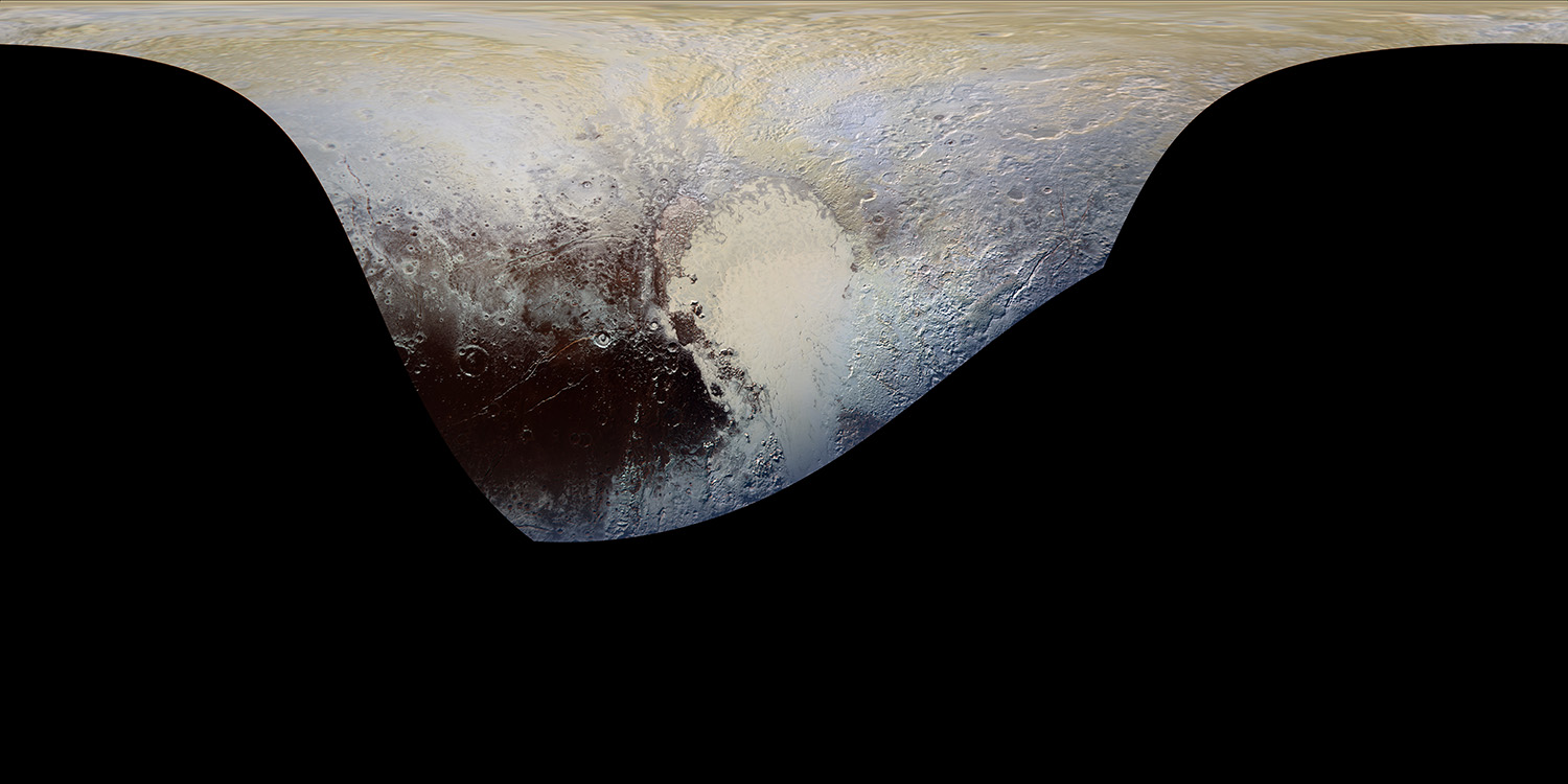
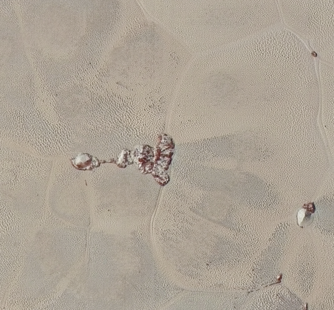
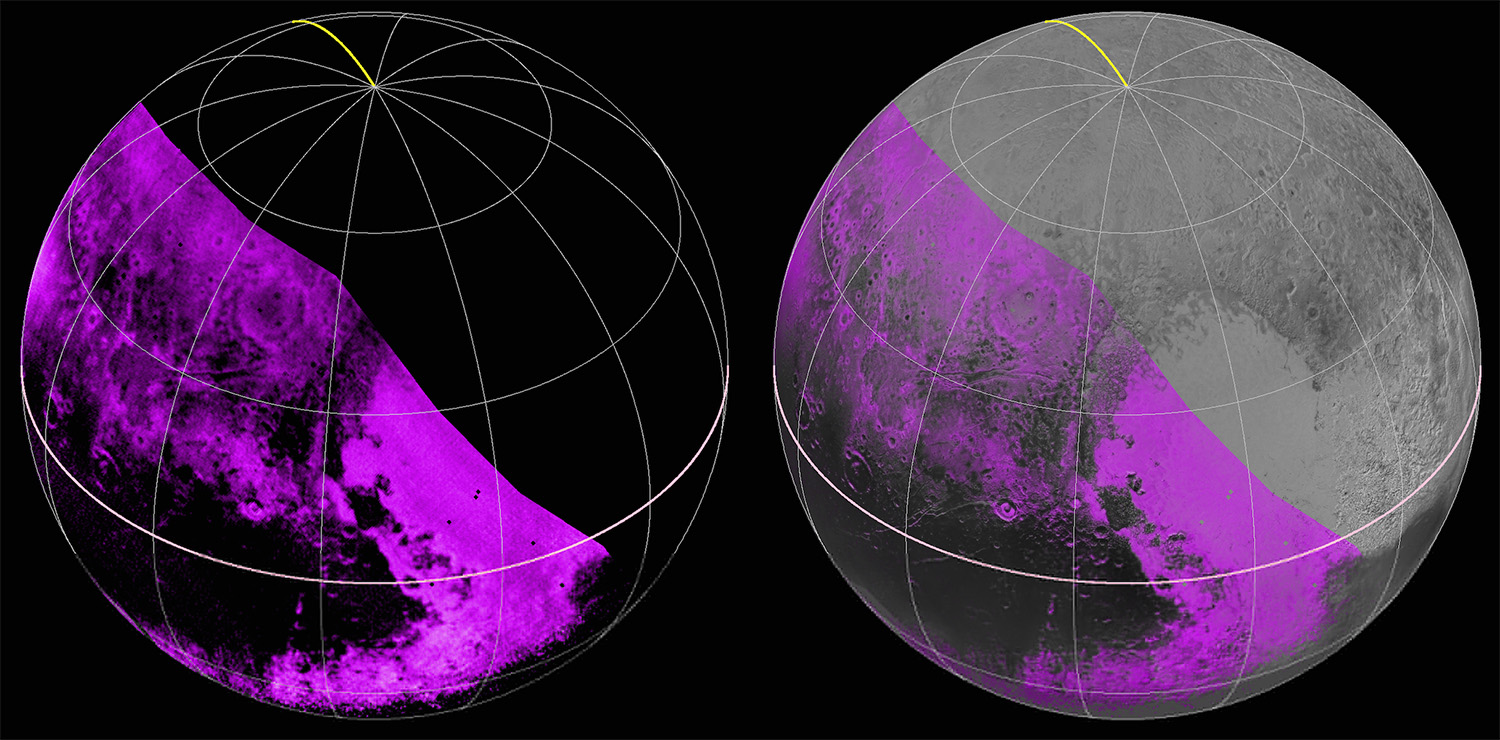
New Dazzling And Mystifying Images Of Pluto in Technicolor!

In this extended color image of Pluto taken by NASA’s New Horizons spacecraft, rounded and bizarrely textured mountains, informally named the Tartarus Dorsa, rise up along Pluto’s day-night terminator and show intricate but puzzling patterns of blue-gray ridges and reddish material in between. This view, roughly 330 miles (530 kilometers) across, combines blue, red and infrared images taken by the Ralph/Multispectral Visual Imaging Camera (MVIC) on July 14, 2015, and resolves details and colors on scales as small as 0.8 miles (1.3 kilometers). Credits: NASA/JHUAPL/SWRI
This cylindrical projection map of Pluto, in enhanced, extended color, is the most detailed color map of Pluto ever made. It uses recently returned color imagery from the New Horizons Ralph camera, which is draped onto a base map of images from the NASA’s spacecraft’s Long Range Reconnaissance Imager (LORRI). The map can be zoomed in to reveal exquisite detail with high scientific value. Color variations have been enhanced to bring out subtle differences. Colors used in this map are the blue, red, and near-infrared filter channels of the Ralph instrument. Credits: NASA/JHUAPL/SWRI
High-resolution images of Pluto taken by NASA’s New Horizons spacecraft just before closest approach on July 14, 2015, reveal features as small as 270 yards (250 meters) across, from craters to faulted mountain blocks, to the textured surface of the vast basin informally called Sputnik Planum. Enhanced color has been added from the global color image. This image is about 330 miles (530 kilometers) across. For optimal viewing, zoom in on the image on a larger screen. Credits: NASA/JHUAPL/SWRI
High-resolution images of Pluto taken by NASA’s New Horizons spacecraft just before closest approach on July 14, 2015, are the sharpest images to date of Pluto’s varied terrain—revealing details down to scales of 270 meters. In this 75-mile (120-kilometer) section of the taken from the larger, high-resolution mosaic above, the textured surface of the plain surrounds two isolated ice mountains. Credits: NASA/JHUAPL/SWRI
The Ralph/LEISA infrared spectrometer on NASA’s New Horizons spacecraft mapped compositions across Pluto’s surface as it flew by on July 14. On the left, a map of methane ice abundance shows striking regional differences, with stronger methane absorption indicated by the brighter purple colors here, and lower abundances shown in black. Data have only been received so far for the left half of Pluto’s disk. At right, the methane map is merged with higher-resolution images from the spacecraft’s Long Range Reconnaissance Imager (LORRI). Credits: NASA/JHUAPL/SWRI

For the original Pluto press release, click here.

To access the full features of Pluto Safari please download the FREE app for iOS from the Apple App Store or Pluto Safari: New Horizons for Android from Google Play.

Alternatively, if you have SkySafari or Pluto Safari installed you could download the simulation settings file here.